

 From I 95 NORTH toward Baltimore: Take Exit #49A which will be I 695 (Baltimore Beltway) East toward Glen Burnie/Key Bridge. Continue on I 695 East, which may become I 695 North before you leave the Beltway. (You WILL cross Key Bridge from this direction for which you should be prepared to pay toll.) Shortly after crossing the bridge, take Exit #43 which will be Bethlehem Blvd/MD 158/Peninsula Expy (MD 157) toward Sparrows Point. At end of ramp, turn Left. This will be Bethlehem Blvd. Continue on Bethlehem Boulevard Straight ahead through intersection with a traffic light (ignoring North Point BOULEVARD which you will cross). You will now be on North Point ROAD. Continue with "Craighill Channel Front Common Directions" below.
From I 95 SOUTH toward Baltimore: Take I 695 (Baltimore Beltway) East (unnumbered exit) toward Beltway/Essex, which will become I 695 South toward Key Bridge/Sparrows Point before you leave the Beltway. (You will NOT cross Key Bridge from this direction.) Take Exit #42 which will be MD 151 South toward Sparrows Point. Stay Right at split on ramp. At end of ramp, turn Right. This is North Point BOULEVARD. Get IMMEDIATELY into Left lane and turn Left, at traffic light, on North Point ROAD (ignoring North Point BOULEVARD which will continue Straight ahead). Continue with "Craighill Channel Front Common Directions" below.
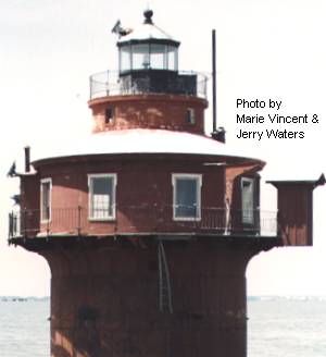
Craighill Channel Front Common Directions: Continue on North Point ROAD. Bear Left on Bay Shore Road. Turn Right on Old Bay Shore Road into North Point State Park (for which you should be prepared to pay an entrance fee). With the use of good binoculars you may get good views of the lighthouse from at least two beach areas. The very best view, if accessible to the public, would be from a narrow strip of land jutting out into the bay to the right of the beach areas. If, for any reason, you cannot enter North Point State Park, return to Bay Shore Road and turn Left on it. Turn Right on North Point Road, Right on Millers Island Road, Right on Baylight Avenue, and Right on Chesapeake Avenue. To the Left between buildings, again using good binoculars, you can get alternate views of this lighthouse from an even greater distance. (There is no land from which you can view this lighthouse very closely.)
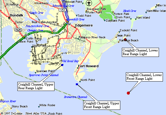
| Large Area Map | Detailed Local Map |
| Some of these maps are large in size and may take a minute or two to load. | |
 2001(c) Chesapeake Chapter, USLHS. All rights reserved.
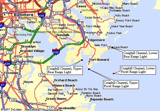