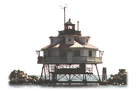


Thomas Point Shoal, Maryland
 Perhaps
the most photographed lighthouse in The Chesapeake Bay, The Thomas
Point Shoal Lighthouse is the last screwpile structure left on its original
sitein the bay. It went into service on November 27, 1875, to replace a
light on the shore at Thomas Point at the entrance to the South River. The
Lighthouse Board thought that a light on the shoal would better serve the
shipping traffic in the bay. A screwpile with a hexagonal 1-1/2-story
building perched on the spidery legs, the light's lantern rises out of the
center of the building. During its early years floating ice tipped over
the fourth-order lens in the lantern. In time heavy riprap was placed around
the lighthouse to fend off the ice. With its red roof and white sides this
picturesque lighthouse is a fine example of its type. The light and fog
signal, both now automated, are still active.
A ceremony was held at the Annapolis City Dock on May 1st 2004 authorizing the transfer of the Thomas Point Shoal lighthouse to a public-private partnership, which includes the U.S Lighthouse Society and the Chesapeake Chapter. The partnerships intensions are to focus on the historic preservation of the lighthouse, and to use the historic site for public education and cultural activities. The goal is to open the offshore lighthouse for public tours, initially on weekends during the boating season. More information will be available at this website and the Thomas Point website at http://www.thomaspointlighthouse.org/.
This was the last staffed lighthouse
in the Chesapeake Bay.
NR. [U.S. Coast Guard]

Thomas Point is another light that you can not get to with most cars. It is located about 1.25 miles off shore. You can see the light from Thomas Point State Park.
From the Washington Beltway, Interstate 95, 495, go east on US Route 50 to exit 22, just before Annaplois.
Exit south on State Route 665, Aris T Allen Blvd.
This road becomes Forest drive.
Go about 2.5 miles until you come to Arundel On the Bay Road. There is a sign for the Coast Guard Station on the right at this road.
Turn right onto Arundel On the Bay Road.
Follow Arundel On the Bay Road (also called Thomas Point Road) for about 1.4 miles untill the road turns into Thomas Point Road.
Continue on Thomas Point Road to the end of the road. This is only about a half mile.
At the end of the road is Thomas Point State Park. The gate opens at 8:00 am. Drive to the end of the road in the park and the lighthouse can be seen 1.25 miles due east.
| Large Area Map | Detailed Local Map |
| Some of these maps are large in size and may take a minute or two to load. | |
 2001(c) Chesapeake Chapter, USLHS. All rights reserved.